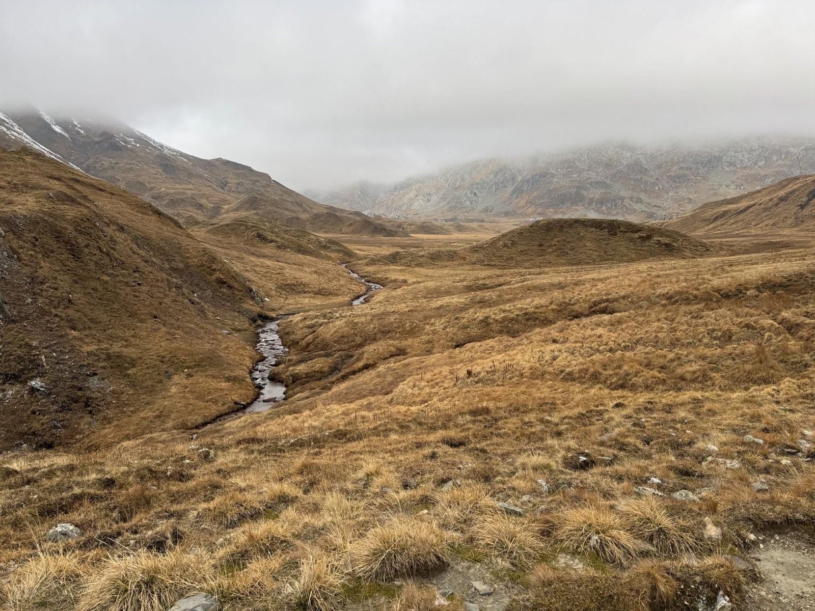
We completed this three-day hut hike in the middle of October, after the staffed season had already ended. The route begins in Campo Blenio in Ticino, crosses the Greina and the European watershed, and finishes in Curaglia in Graubünden. Outside the main season, it can feel exceptionally quiet, but snow, ice and unstaffed huts require much more attention.
What makes the tour particularly interesting to me is how much the landscape and character change from one day to the next. Both nights can also be spent in winter rooms when the main huts are closed.
Getting to Campo Blenio
We travelled from Zurich to Bellinzona, turned north again through Biasca, and continued by bus via Olivone to Campo Blenio, where the actual hike began.
Day one: Campo Blenio to Capanna Motterascio
The first section climbs fairly steeply through varied, lightly wooded terrain towards Lago di Luzzone. The path then follows the reservoir for a long time, passing through a few short tunnels and repeatedly opening views over the water and surrounding mountains, including Pizzo Pianca.
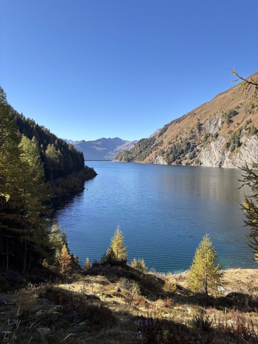
At the far end of the lake, the landscape begins to change. The trail steepens again, passing waterfalls as it climbs higher. At the same time, the views open towards the larger peaks around the valley, including Plattenberg, the Vernokhörner and Torrone di Garzora.
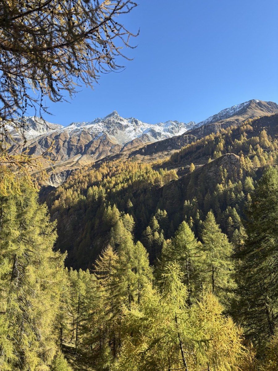
Eventually, you reach Capanna Motterascio at about 2,170 metres. Because we were there in mid-October, the staffed hut was already closed and only the winter room was available. For us, it was entirely sufficient.
A large sun terrace lies in front of the hut. If you arrive early and, as in our case, meet hardly anyone else, it is an excellent place to let the afternoon come to an end.
The winter room had a wood stove, a small but adequate kitchen and a comfortable dormitory. Enough blankets were available, although your own sleeping equipment still needs to match the season and the possibility of an unheated room.
Day two: across the Greina to Camona da Medel
The next morning, we had several options. We briefly considered continuing across the Greina towards Terrihütte. There was reportedly already some snow in that direction, and our intended destination was Camona da Medel in any case.
Camona da Medel was also unstaffed at this time of year, so our second night would again be in a winter room.
From Capanna Motterascio, we climbed towards Plaun la Greina. The Greina is an extensive plateau at roughly 2,200 metres, crossed by countless small streams, pools and wet areas.
This landscape feels very different from many other high Alpine hikes. It is a broad high-mountain landscape rather than a narrow pass corridor. Instead of moving constantly through steep rock and scree, you cross an unexpectedly open plain threaded by watercourses. Much higher mountains still frame it on every side.
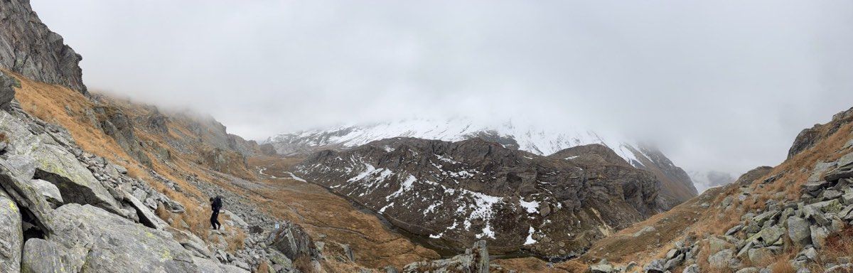
We followed the route towards Passo della Greina. Ice and some snow were already present on shaded northern slopes. Most sections were still straightforward, although trekking poles or light traction devices would have been useful in a few places.
The climb from the south remained relatively comfortable for us despite the season. We gained height through blocky terrain, at times in fog. The markings were generally clear enough to follow.
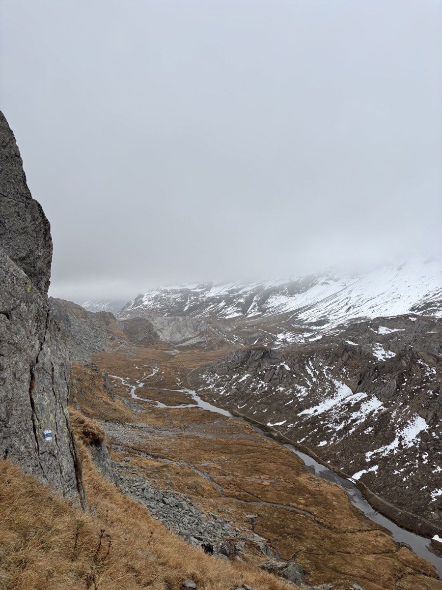
Other hikers at Motterascio had warned us the evening before to expect snow on the northern side. They were right.
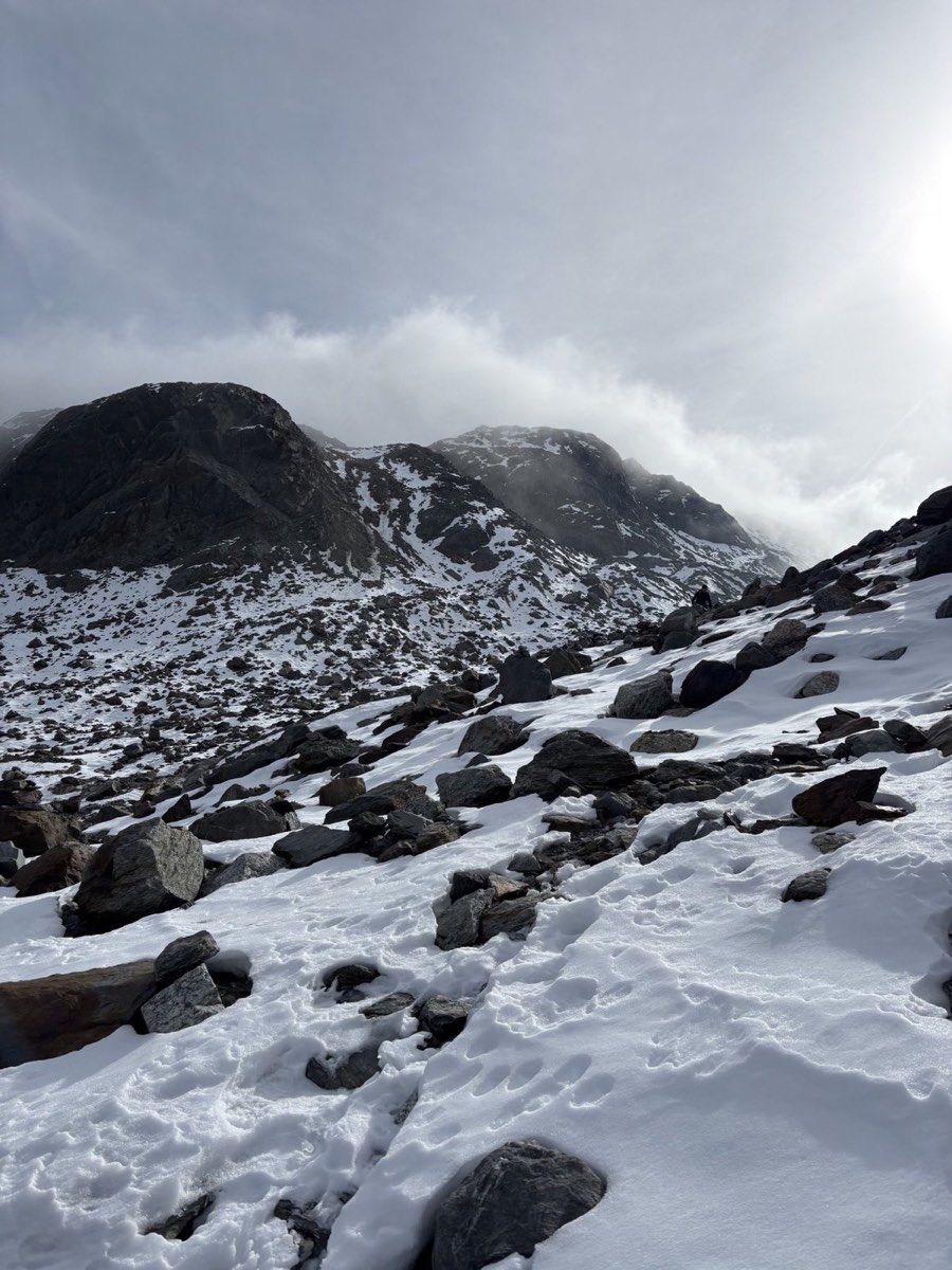
The upper 200 to 300 vertical metres of the descent held substantially more snow. We moved much more slowly and cautiously. Knowing that other hikers had crossed the same section in the opposite direction the previous day was useful information, but of course did not replace our own assessment of the conditions.
As we descended, the snow gradually decreased. Below roughly 2,400 metres, the landscape returned to largely snow-free ground.
After the long descent, one final climb remained. From around 2,200 metres, the path rose gently at first and then more steeply towards Camona da Medel.
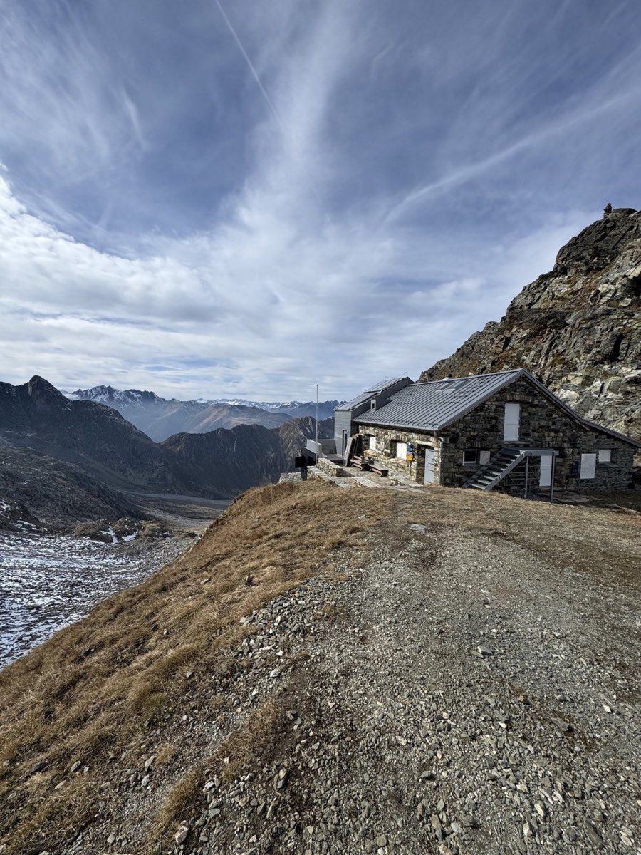
Its winter room was modern and comfortable but considerably smaller than the one at Capanna Motterascio. At first, we assumed we would have the whole hut to ourselves. Later, two other students from Zurich arrived from the Graubünden side.
With four people, the room felt very comfortable. At full capacity, with roughly ten to twelve people, I imagine it would become quite tight.
Ways to avoid Fuorcla Sura da Lavaz
If the blue-and-white crossing is too demanding, the route can be changed without giving up the Greina itself.
One option is to descend from the Greina via Terrihütte and continue into the valley. This turns the trip into a two-day hike. The descent on the second day is long, but you still experience the plateau and avoid the alpine crossing entirely.
Another option is to continue from the Greina to Capanna Scaletta and spend the second night there. During the staffed summer season, it makes a convenient stop, followed by a much more relaxed descent on day three.
It is theoretically possible to reach Camona da Medel via Terrihütte and then climb back up on the normal hut approach. That version is very long and adds a substantial amount of ascent. I would only consider it if you deliberately want an exceptionally long day and need to avoid the blue-and-white route.
That flexibility is one of the strengths of the area. The length and difficulty can be adjusted without giving up the Greina itself.
Day three: down to Curaglia
The next morning, we finally descended into the valley. Heavier snowfall was forecast for the following days, and we were glad to have crossed the high ground before the weather changed.
Compared with the previous day, the descent from Camona da Medel to Curaglia was straightforward and went quickly. It covered about 7.8 kilometres and 1,190 metres of descent. After the first two stages, it felt like a comparatively relaxed finish.
The route ended in Curaglia directly beside public transport.
Why the complete route stayed with me
I particularly liked the combination of all three days. The first begins in the greener, more wooded landscape of Ticino, follows Lago di Luzzone and climbs to Capanna Motterascio. The second crosses the broad Greina plateau before reaching the much more alpine high point at Fuorcla Sura da Lavaz. On the third, you descend on the other side of the Alps into Graubünden.
In mid-October, the route was exceptionally quiet. Both huts were unstaffed, and we met few people on the trails. The disadvantage was equally clear: above roughly 2,500 metres, snow and ice can already be present, and conditions can change quickly.
I would only attempt the hike at this time of year after checking current conditions carefully and carrying appropriate equipment for possible snow and ice. During the normal summer season, the same route is considerably more straightforward and both huts are usually staffed.
If you want a longer hut hike that connects Ticino and Graubünden and feels different every day, the route via Motterascio, the Greina and Camona da Medel is, for me, a particularly interesting option.